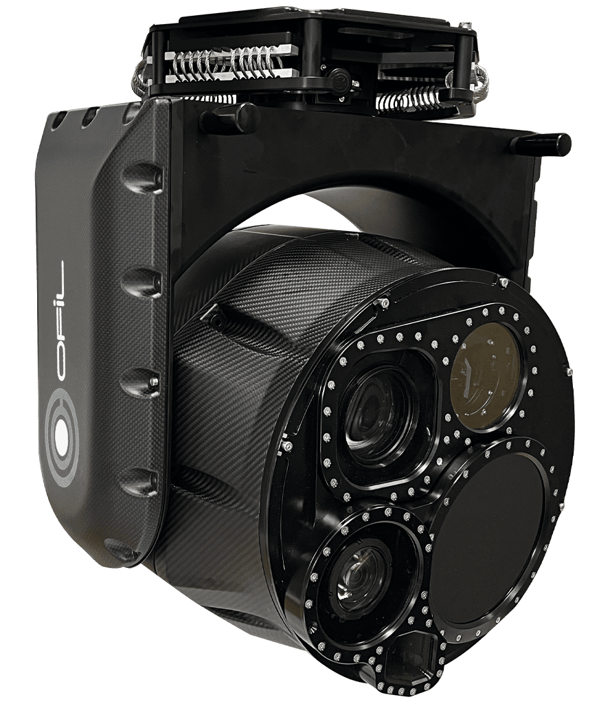
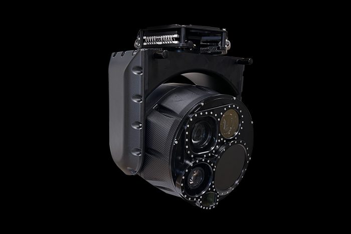
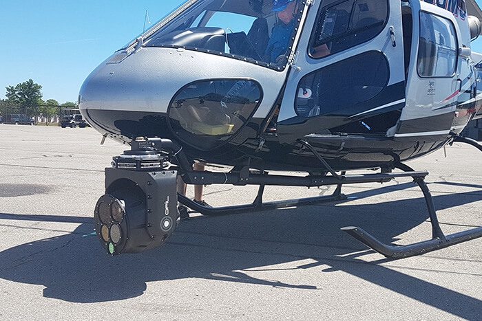
Multispectral 5-sensor gimbal with 4-axis precision stabilization. The ideal choice for the expert users of IR & UV flight inspections with the need for enhanced functionality.
Scroll down to explore
sensors
0
IR UV EO HighResPhoto LRF
axis
0
gyro-stabilized fiber optic IMUs
0°
Continuous
kg/
0
lbs
0
depending on configuration
System Features
The combination of a high bandwidth architecture, high-end stabilization performance plus deep integration of high-end sensors delivers uncompromising data quality and inspection efficiency.
POWERFUL SYSTEM DESIGN
Fiberoptic inertial measurement units (IMUs) deliver superior turret stabilization granting highest measurement precision with ultra low noise and drift
The fiberoptic network architecture provides ultra high data bandwidth, allowing data to be recorded uncompressed, with minimal latency.
Only a single hybrid fiber cable is required between the gimbal and the helicopter, allowing for a fast and easy installation/start of operation, noise free high speed data transmission, free of electromagnetic interferences
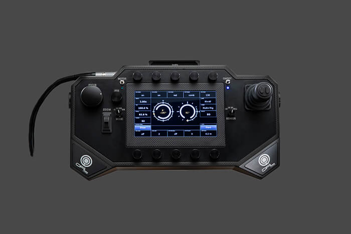
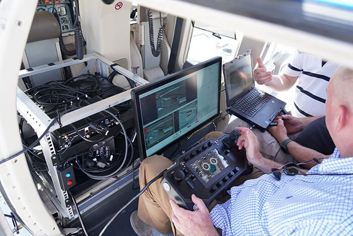
Ease-of-use & Highest Sensor Integration
The highly intuative GCU “Graphical Control Unit” controls all aspects of the system. Various dials command the numerous sensor functions, that are deeply integrated into the system. A touch screen allows operators to customize screen layouts and functions to their preference.
Deep integration of sensor functions
Settings & Layouts fully customizable
Ability to save to individual user profiles
Advanced Autofocus & Focus Tracking
Payload sensor package
The 4 to 5 sensor payload usually consists of the following standard components and will be customized upon customer request:
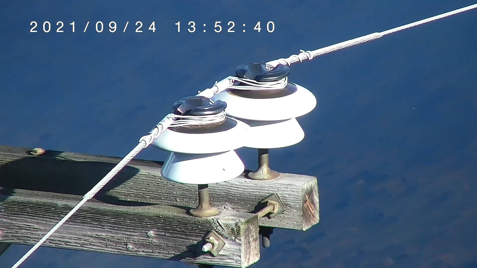
HD Thermographic Infrared Camera
4K Electro-Optical Video Camera
HD UV/Corona Camera made by OFIL
High Res. 61 MP (Full Frame) Photo Camera
Choice of 100/120MP Still sensors LRF Laser Range Finder
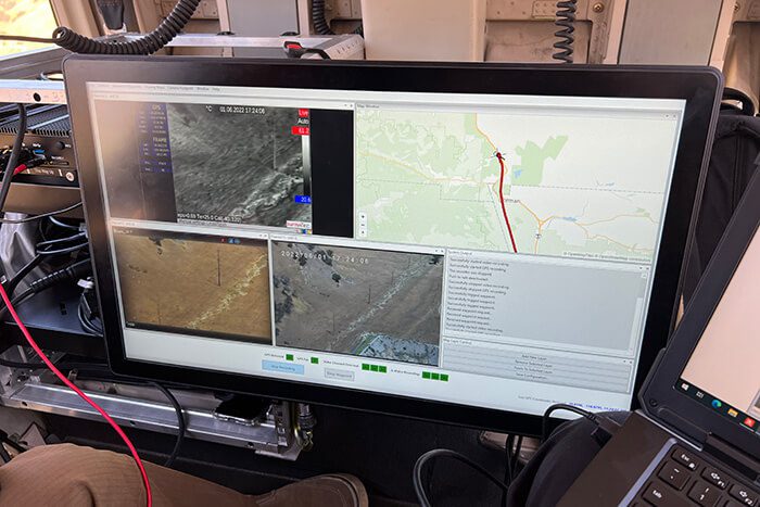
Geo-referenced data (video & image data)
All 4K & HD video and image data is geo-referenced (GPS of platform and target) using the IMU/GPS/LRF. The Geo-lock function to automatically hold the target reference position in flight is available as an option.
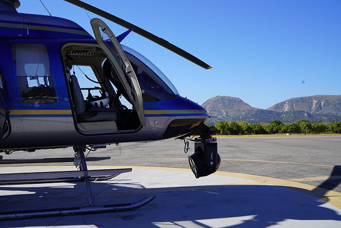
Helicopter mounts & racks
We advise you on the various options for helicopter mounting systems and tailored racks for individual working enviroments within the cockpit
Support
We provide tailored training and installation support for deployment, and pride ourselves on exceptional and reactive customer service.
Furthermore we offer:
24 months of warranty (from date of delivery)
Free annual service during warranty period
OFIL global network with offices in USA, Europe & Asia
Technical Specifications ROM Ultra
GIMBAL TURRET
High performance 4 axis gyro stabilization
Fiber optic IMU, ultra low noise and drift
Coverage: 360° azimuth, +20° to -180° elevation
Weight: aprox. 37 kg/81,6 lbs (depending on configuration)
Connections: single rugged hybrid fiberglas cable
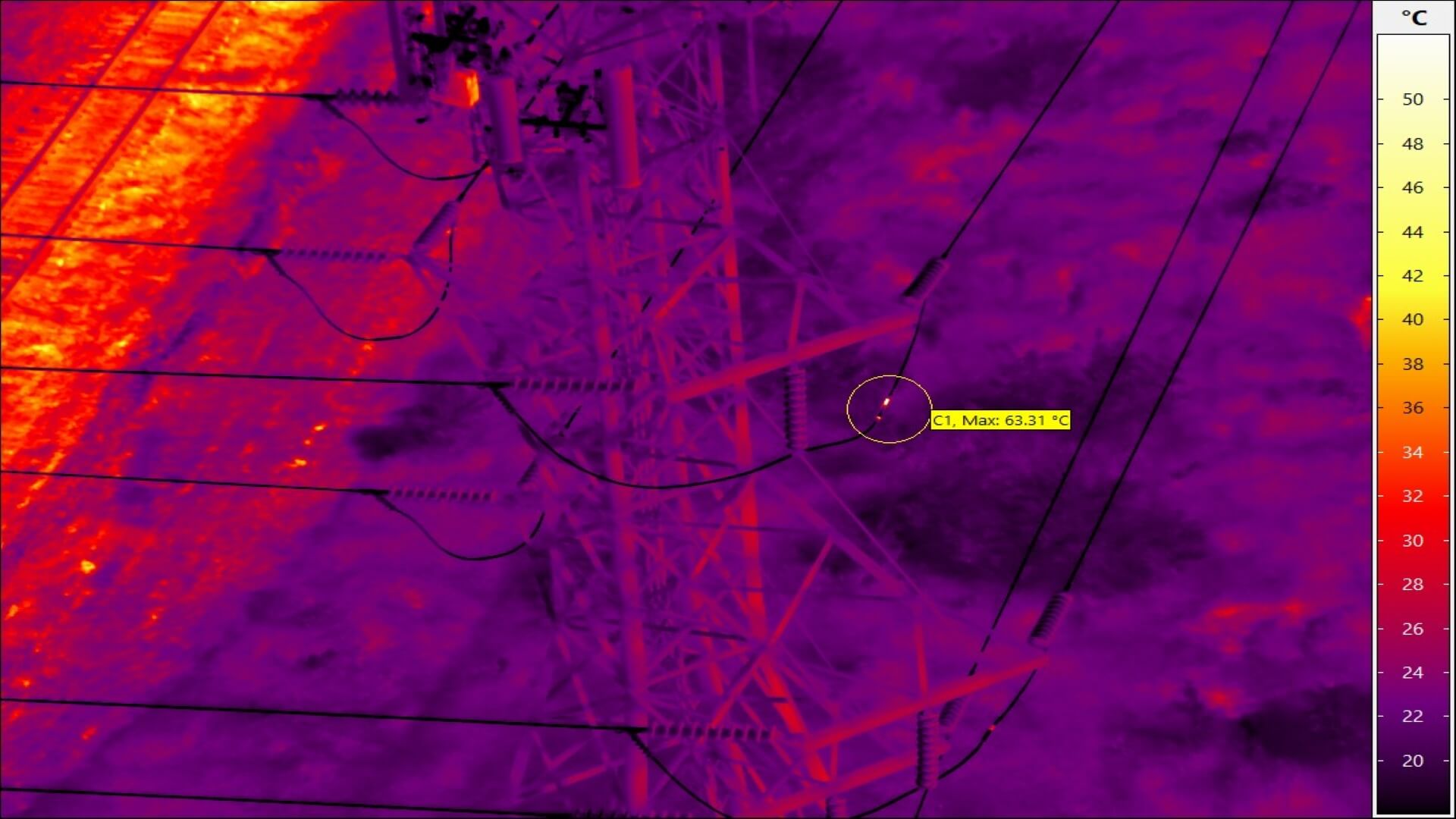
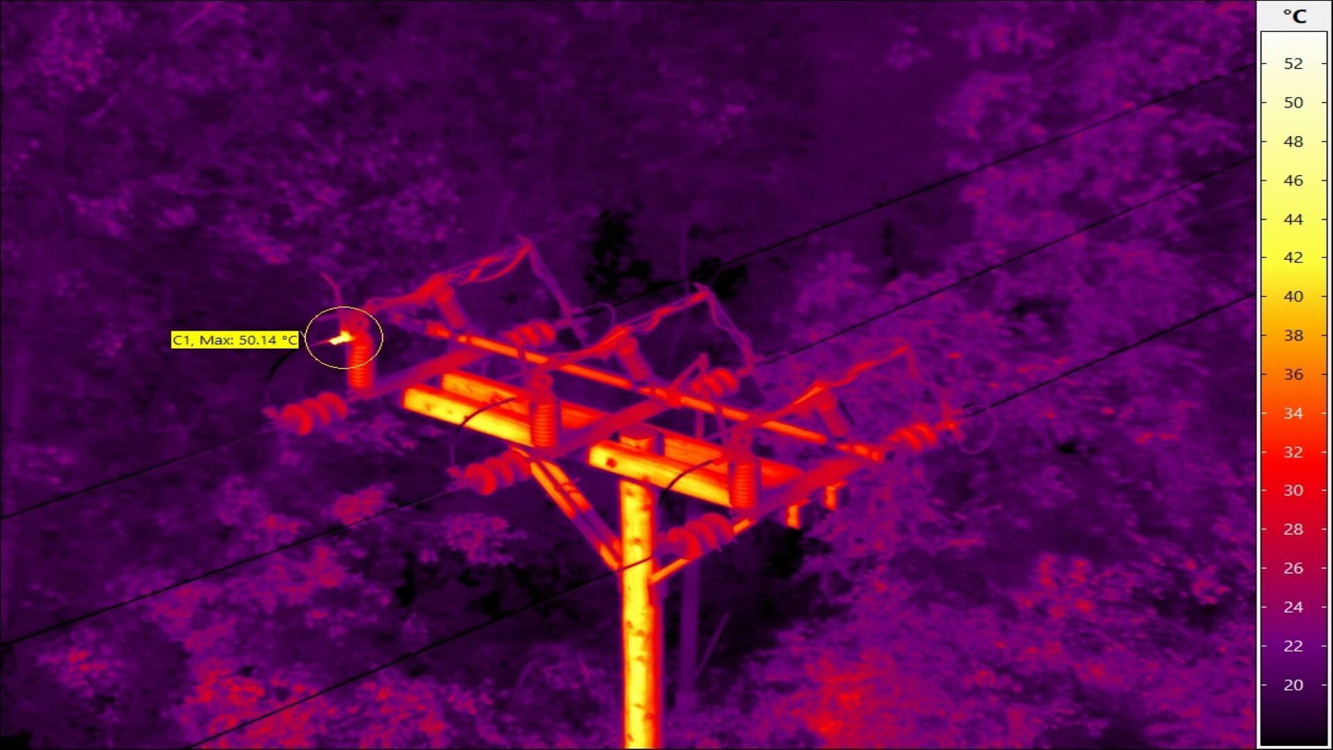
HD INFRARED THERMOGRAPHIC CAMERA
Radiometric HD LWIR with fixed focal lens
FOV: 120mm lens / 8°x6°
Option for radiometric cooled IR with 7.5x optical zoom
HD UV CORONA CAMERA
OFIL DayCor® solar blind bi-spectral UV sensor
High Sensitivity HD UV Imager & visible overlay
6x optical zoom
4K ElectroOptical EO VIDEO CAMERA
High Sensitivity Color CMOS imager in 4K
30x optical zoom
HighRes PHOTO CAMERA
61MP Sony A7RIV (standard) with zoom lens
Zoom lens 140-400mm, F 5.6
Options for up to 100MP (FUJI/Canon) or 120MP (Phase ONE)
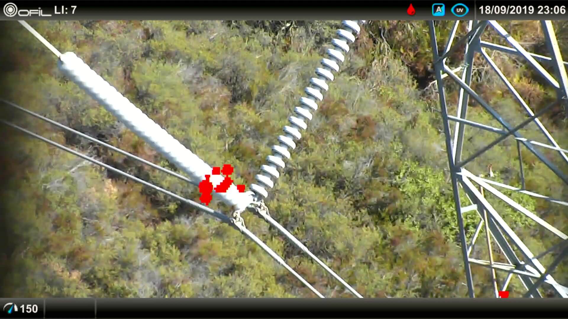
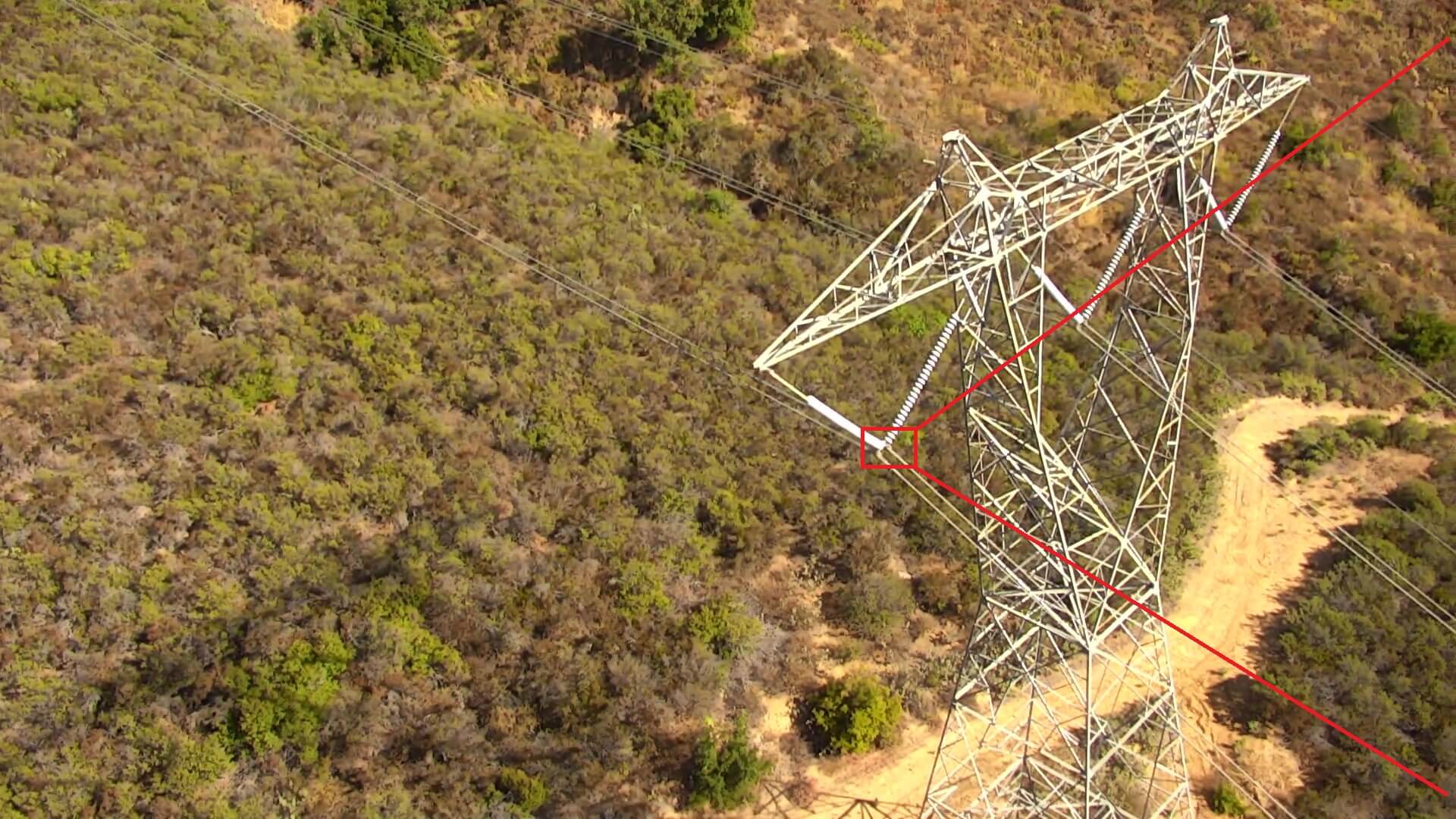
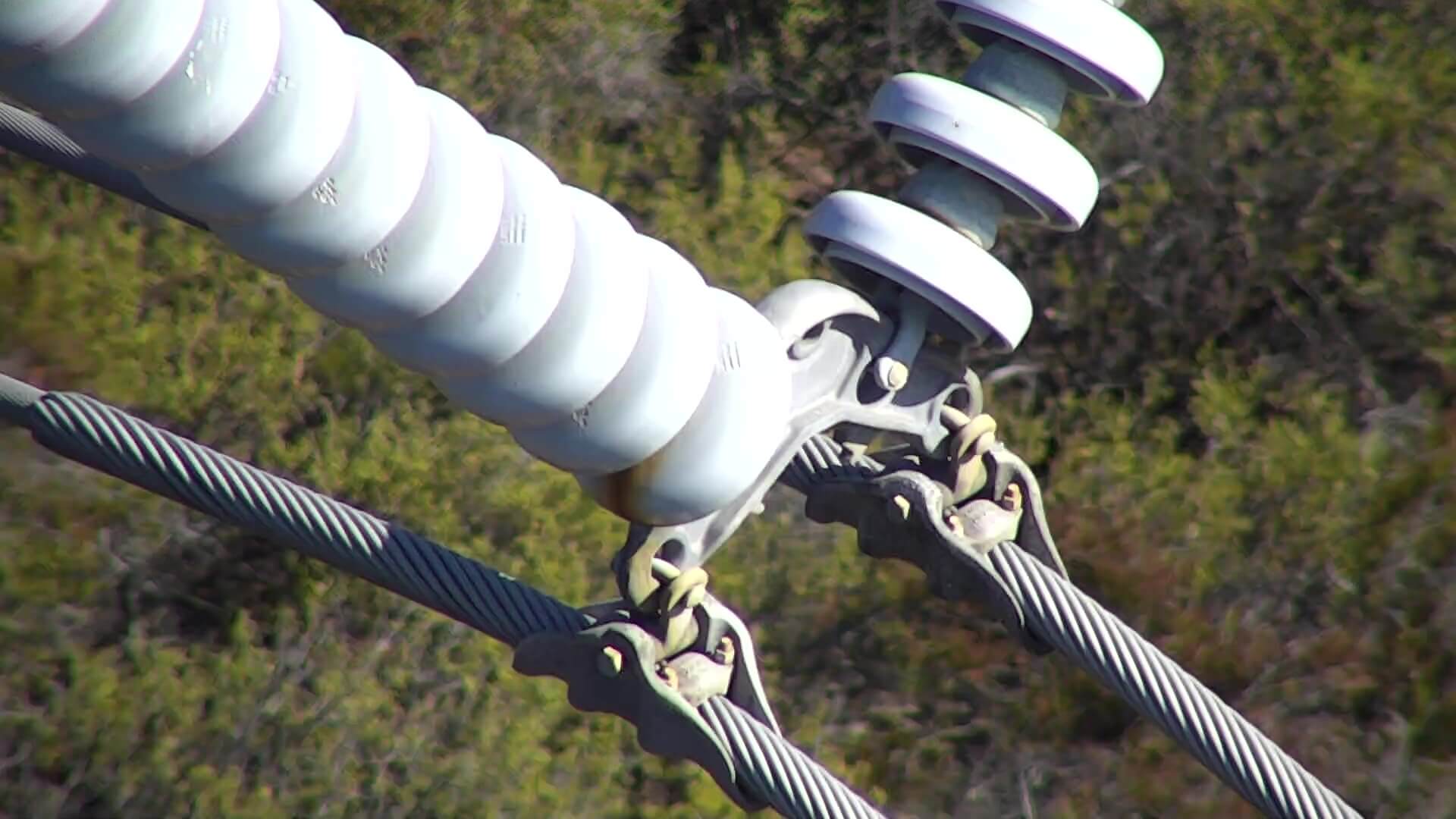
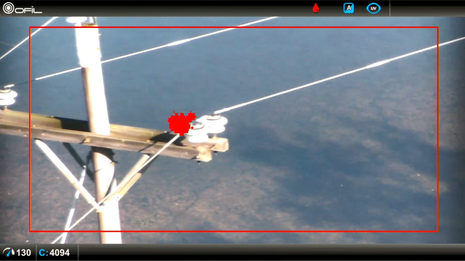
IR (HD), UV (HD) and Optical (4K/HD) video channels are recorded in uncompressed full resolutions, including the Geo-reference (GPS of target and aircraft). Faults can either be marked with a single press of a button, or triggered/detected through advanced intelligent functions; with the Geo-referenced 61-120 MP resolution images and radiometric IR data automatically recorded for each fault.
Click to enlarge
Questions, enquiries and partnership opportunities